Since the first hand drawn maps of the stars to satellite imagery and GPS navigation today, our frame of reference and our perception of space has been molded into a view from above. Our understanding of place is often linked to an abstract representation on a map rather than a physical relational comprehension. You could probably point out Azerbaijan on a map, but how many of us can simply point in its direction across the globe? The image of the globe projected onto a vertical surface is so pervasive, we often associate “up” with north as we project ourselves into a mental image of map.
The accessibility of GPS and online map services have continued to reinforce the “up” vector while creating a greater divide between the physical world and its virtual representations. Today, we view from above, as primarily experienced on our screens, in an elevation view without any regard to its physical context. We project our presence into the screen through multiple translations of orientation. Viewing a map on a computer screen requires one to find a location on the screen that represents a position, then the abstracted orientation of the vertical screen must be translated and scaled into the physical context of the current position. We’ve lost a step in comprehension without the compass and the horizontal map. The traditional map and compass gave an intuitive understanding of a current position in relation to physical space by rotating the map to align with the space it represented. What appeared one inch to the left of my location on the map could be confirmed by looking up to my left.
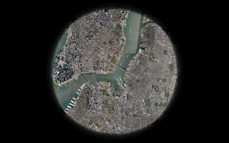
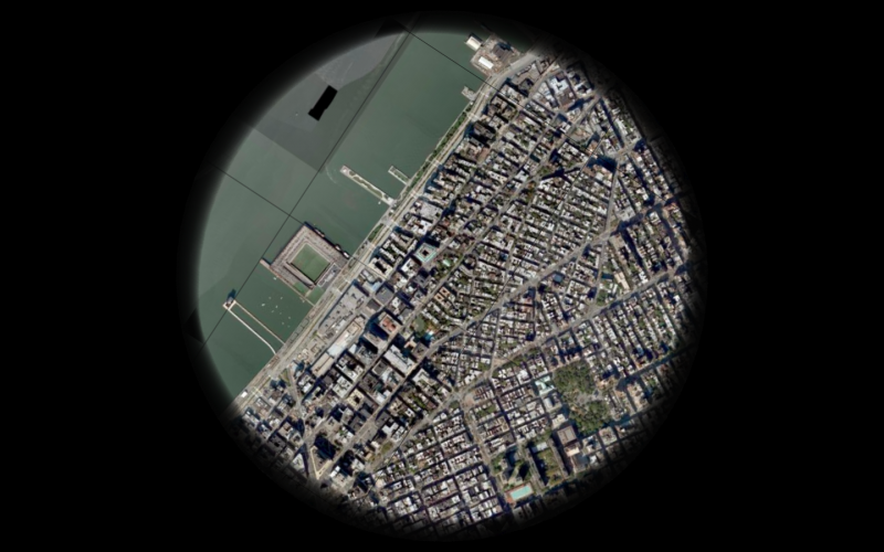
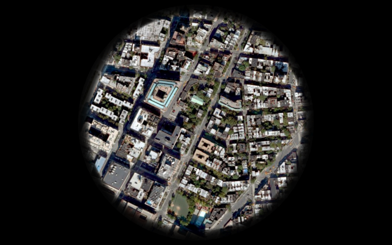
Ornos is a telescopic view from above. The horizontal screen reconstructs a view from a position directly above itself using satellite imagery and maps. Exploring your current surroundings is as simple as sliding the device on any surface to pan across the globe. Zooming is controlled by rotating the device itself. The onboard digital compass and GPS modules orient the image on the screen to reflect your physical surroundings while satellite imagery and maps are dynamically loaded from Google, Microsoft, or Yahoo.
Ornos : Prototype 01 from che-wei wang on Vimeo.
Here’s the first test with Ornos. The compass readings are behaving pretty well considering it’s right underneath a spinning hard drive. The 1.2Ghz processor and 512 RAM don’t seem to be enough to download and render the image quickly enough, so I’m going to have to figure out how to speed things up.