Tetherlight

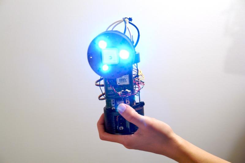
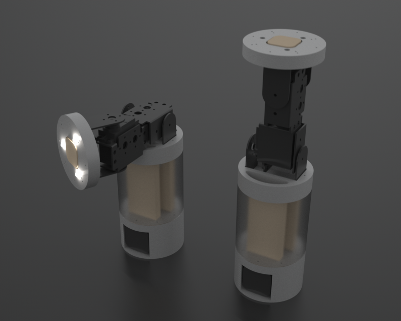
Tetherlight is a hand held light that perpetually points at its sibling. Two Tetherlights constantly point at each other, guiding one Tetherlight to the other with a beam of light.


Tetherlight: Prototype 02 Rotation from che-wei wang on Vimeo.

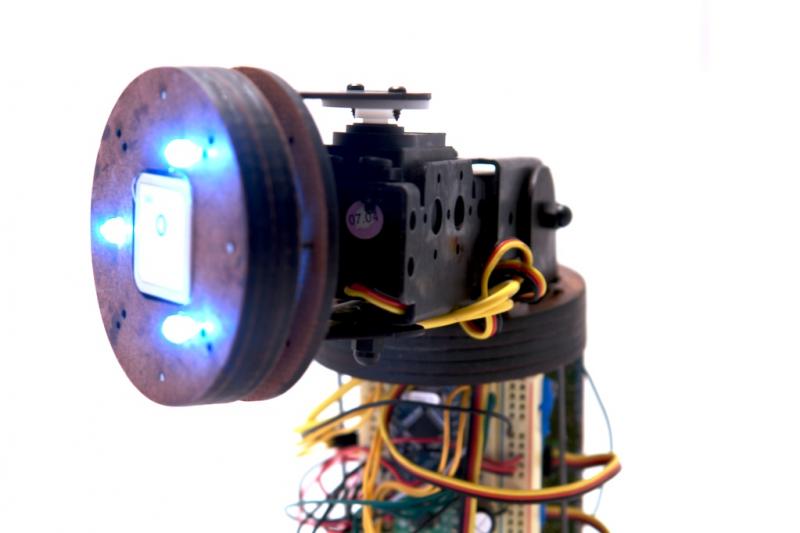
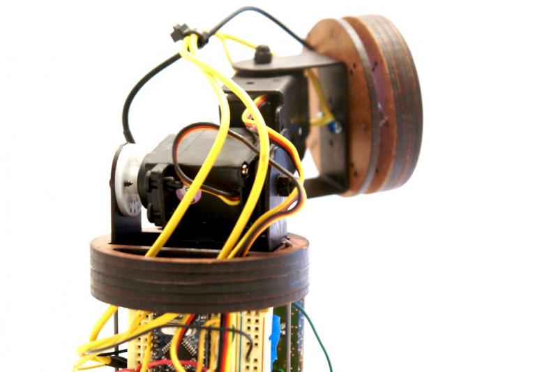
The devices are each equipped with a GPS module, a digital compass, and a wireless communication module to locate, orient, and communicate its position to the other. They each calculate the proper alignment of a robotic neck to point a light in the other’s direction. In order to maintain the light’s orientation, an accelerometer compensates for the device’s tilt.

Tetherlights are for loving spouses, cheating spouses, girlfriends, boyfriends, children, pets, bags of money, packages, and pretty much anything that you would want to locate at a glance. An ideal use of Tetherlights would be in a situation where two people or two groups of people need to wander, but also need to locate one another in an instant. In a hiking scenario, a large group might spit up to accommodate different paces. With Tetherlights, understanding one’s whereabouts in relation to the other group is represented spatially with a bright light in the appropriate direction.

Tetherlight attempts to make one’s relation to a distant person more immediate by making a physical pointer instead of an abstract maps. With traditional maps, people need to communicate their positions, orient their maps, locate a point on the map, then look up in that direction. Tetherlight does it in an instant. The difference is like looking at a map to see where your uncle lives or having a string that’s always attached to him.

If you’re interested, here’s the Arduino Code: Tetherlight06xbeeGPS.pde

Laser Tether : Sketch

laser-tether-sketch1.png

Here’s a sketch of how the parts might fit to get the laser to freely point in any direction. 4 servo motors work in tandem to tilt the laser head. Batteries and the circuitry is stored in the bottom half of the cylinder. I was going to have a mechanical gyro to have it orient itself to the ground, but the form seemed too restricted, so I’m opting for a gyro sensor to deal with orienting the device to gravity.

Laser Tether

laser_caution.gif

The Laser Tether is a hand held laser pointer that perpetually points at its sibling. Two Laser Tethers constantly point at each other no matter where they are on the globe. If my cousin in Beijing had a Laser Tether and I turned on mine in New York City, our lasers would point towards our feet as the lasers draw a straight line through Earth between my cousin and myself.

The devices are each equipped with a GPS module, a digital compass, and a cell network module to locate, orient, and upload its location to an online database. They then calculate the proper alignment of their lasers in relation to the other. In order to maintain an orientation that is always perpendicular to the ground, the lasers are mounted on a self leveling mechanism similar to existing laser levels like the DEWALT DW077KI.

Possible uses for the devices are for loving spouses, cheating spouses, girlfriends, boyfriends, children, pets, bags of money, packages, and pretty much anything that you would want to locate at a glance. Although potential uses are many, the scenarios I have in mind are for hiking, sailing, driving, caravaning, patrolling, playing tag, jogging, getting lost in crowds, hunting, tracking, spying, and battle strategy coordination. An ideal usage of the Laser Tether would be in a situation where two people need to wander, but also need to locate one another in an instant.

With GPS units becoming more pervasive, many GPS tracking applications have databases of people’s known locations. The emerging debate on privacy and accuracy are a major concern ((Katina Michael, Andrew McNamee, MG Michael, “The Emerging Ethics of Humancentric GPS Tracking and Monitoring,” icmb, p. 34, International Conference on Mobile Business (ICMB’06), 2006)), while the abstract representation GPS data in maps fail to convey a strong sense of immediacy and relevance. These applications like Navizon and Mologogo are open to large online communities and are visualized on maps. Common commercial applications of GPS tracking devices are used for fleet control of taxis and trucks, animal control, race tracking, and visualization. ((GPS tracking. (2008, January 27). In Wikipedia, The Free Encyclopedia. Retrieved 04:39, January 30, 2008, from http://en.wikipedia.org/w/index.php?title=GPS_tracking&oldid=187351992))

The Laser Tether attempts to make one’s relation to a distant person more immediate. The difference is like looking at a map to see where your uncle lives versus having a string attached to him.